USGS Unveils First Natural Hydrogen Resources Map in Contiguous United States
Key Ideas
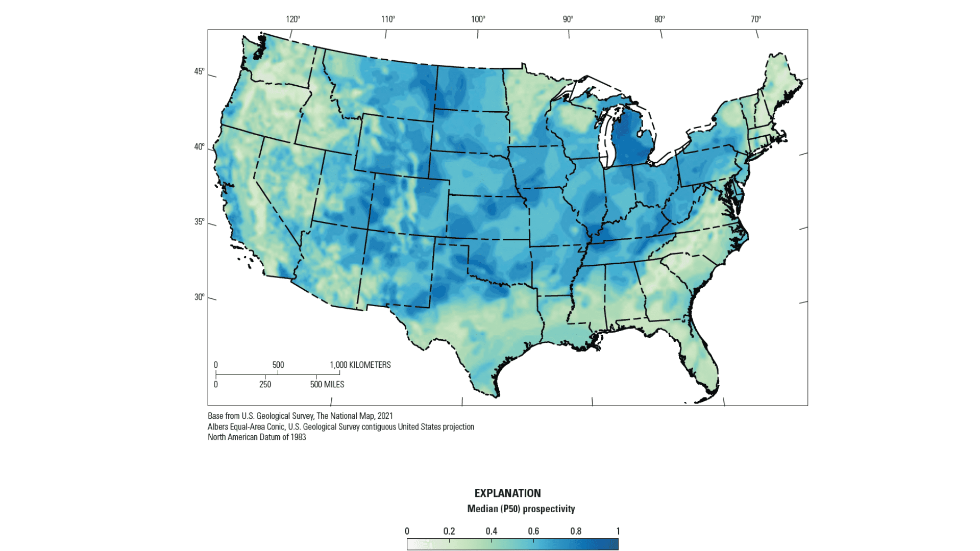
- The USGS has released the first map showing potential natural hydrogen resources in the contiguous United States.
- This map identifies areas in the Midwest, Four Corners states, California's coast, and the Eastern seaboard as potential hot spots for geologic hydrogen.
- Sarah Ryker of the USGS notes a shift in understanding, suggesting that parts of the U.S. could possess subsurface hydrogen resources for energy use.
The U.S. Geological Survey (USGS) has unveiled the first potential natural hydrogen resources map for the contiguous United States. This groundbreaking map was created using a novel method that assesses geologic conditions conducive to hydrogen presence underground. The map highlights potential hot spots for geologic hydrogen across various regions of the U.S., such as the Midwest, Four Corners states (Arizona, Colorado, New Mexico, Utah), California's coastline, and the Eastern seaboard...
The conventional belief that naturally occurring hydrogen was insufficient for energy applications has been challenged by this map. Sarah Ryker, the USGS associate director for energy and minerals, expressed intrigue at the possibility of subsurface hydrogen resources in multiple U.S. regions. This development signifies a paradigm shift in understanding geologic hydrogen accumulations. The map serves as a valuable tool for identifying areas suitable for exploring geologic hydrogen and potentially unlocking new energy resources in the United States.